Please download "Guthook Guides: Hike & Bike Offline" to access the Appalachian Trail, Pinhoti, Benton MacKaye, Long Trail, and Mid State Trail guides. Existing customers may transfer their purchases to the Guthook Guides: Hike & Bike Offline app.
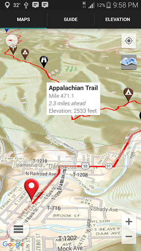
Guthook's Guide to the Appalachian Trail is a detailed, map-based smartphone guide for your hike on the Appalachian Trail or the Long Trail. It maps and lists thousands of important hiker waypoints on the AT (and hundreds for the Long Trail) such as water sources, shelters, tenting sites, road crossings, resupply locations, and many others.
The free demo covers the 8.8-mile Springer Mountain Approach Trail from Amicalola Falls State Park to Springer Mountain southern terminus.
In-app purchases include 9 sections of the AT and the Long Trail in Vermont.
Key features:
- No mobile or internet connection is required after initial setup -- works in Airplane Mode
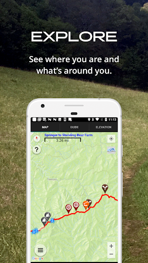
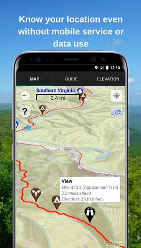
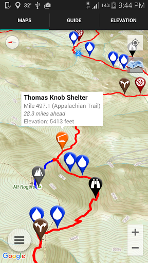
- Detailed maps with your GPS location
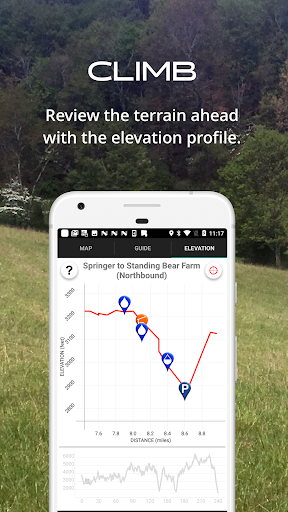
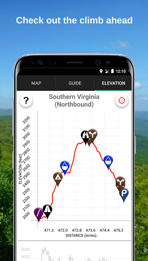
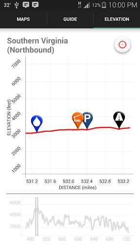
- Elevation profile view
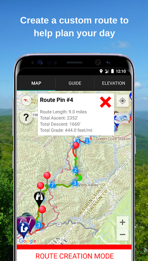
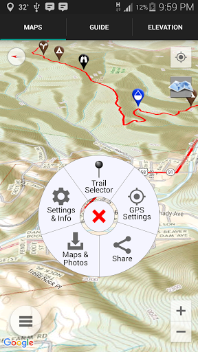
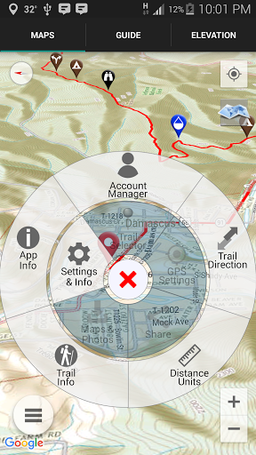
- Custom route creator
- Multiple offline map choices
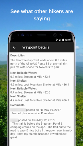
- Real-time comments from other hikers
- Send your current location and a message to friends or family via Checkin feature
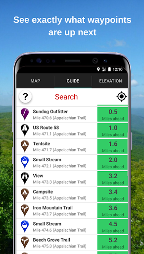
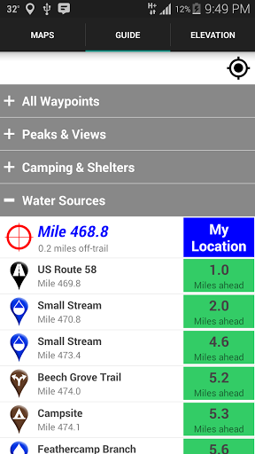
The guidebook lists every waypoint in order by distance along the trail and how far away you are from each waypoint. The guidebook also includes a detailed town guide for major resupply points, towns, and services along the AT.
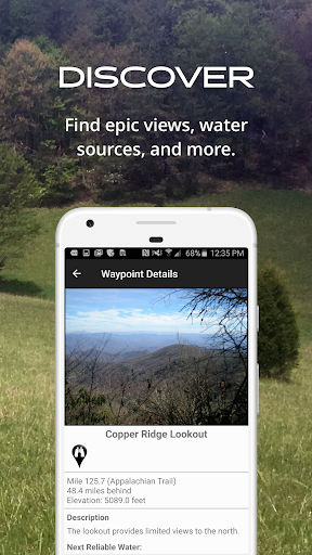
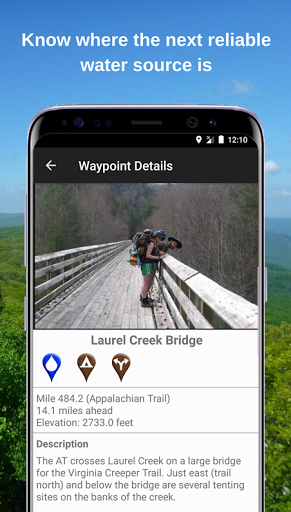
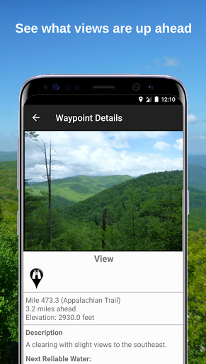
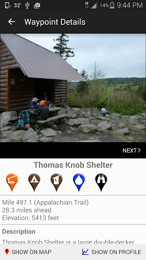
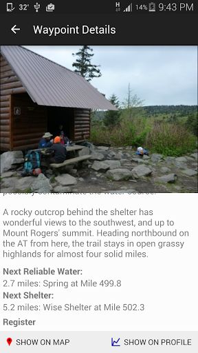
Waypoint details include:
- Mileage point and elevation
- Photographs
- Distance to the next water source and tent site
- Comments section where you may post comments and read other hikers’ comments
Types of waypoints:
- Water sources (including the reliability of each water source)
- Detailed resupply and town information:
- post offices and other package services
- restaurants
- grocery stores and convenience stores
- gear shops and hardware stores
- laundromats
- lodging, public showers, public restrooms
- public libraries
- Tenting sites/camping sites
- Trail junctions
- Parking areas along the trail
- Picnic areas, campgrounds, ranger stations
- Roads, railroad tracks, power lines, fences, gates
- Natural landmarks (e.g. mountain passes)
- Privies/restrooms
- Views
About the Appalachian Trail: The Appalachian Trail, or AT, is one of the United States' most treasured national trails. The 2,168-mile trail stretches from Springer Mountain in Georgia to Mount Katahdin in Maine. Along the way it passes through 14 states, including Georgia, North Carolina, Tennessee, Virginia, West Virginia, Maryland, Pennsylvania, New Jersey, New York, Connecticut, Massachusetts, Vermont, New Hampshire, and Maine. Much of the Long Trail overlaps the AT through the State of Vermont. Many hikers complete the entire trail in one season ("thru-hikers"), and countless others enjoy hiking anywhere from a few miles to hundreds of miles each year.
Appalachian Trail, AT
Fix comments syncing issue (where user cannot see their own comments but other users can see the comments)
New feature: ascent/descent value when you select trail or waypoint when you are on-trail
Bug fixes:
--cut off text in elevation widget
--disappearing photos after force reload
--empty distance info in waypoint panel
Update Privacy Policy / Terms of Use
Update to backend management
Update Terms of Use and Privacy Policy
Bug fixes
6.0--Improved performance/speed--Improved location services--Improved route creator tool--Trail color option for colorblind/dark background6.0.17--fix photo download issue